




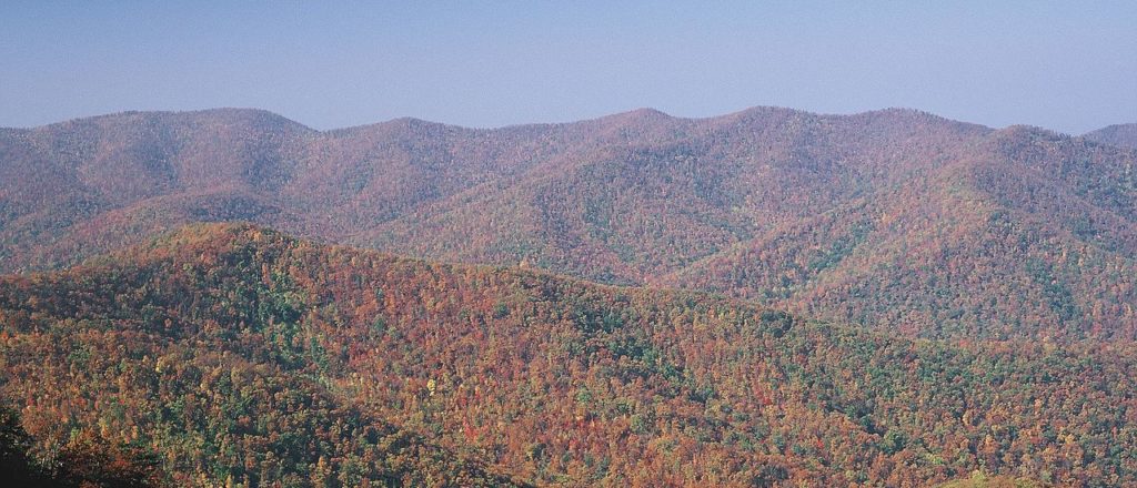
The Appalachian Mountains are a vast mountain range situated in eastern North America, extending roughly 2,050 miles (3,300 km) from central Alabama to Newfoundland along a generally southwest–northeast axis. Alongside the Appalachian Plateau province—with which they are not entirely synonymous—the mountains form a wider system comprising the region's backbone. The range's highest peak is 6,684-foot (2,037 m) Mount Mitchell in the Black Mountains subrange of North Carolina, which themselves are part of the larger Blue Ridge Mountains. Saint Pierre and Miquelon, an overseas collectivity of France, is part of the range, meaning it technically spans portions of three countries. It is geologically related to the Scottish Highlands, Atlas Mountains, Scandinavian Mountains, and Ouachitas, as these ranges all originally belonged to the sprawling Central Pangean Mountains before plate tectonics tore them apart.
The geologic processes that led to the formation of the Appalachian Mountains started around 1.1 billion years ago with the creation of supercontinent Rodinia, and many Precambrian rocks and minerals created via this process remain visible today in the range's outcrops. The modern Appalachians and their relatives themselves were created by a series of three distinct orogenies beginning approximately 480 million years ago, making them one of the oldest surviving mountain ranges in the world. The young Appalachians reached elevations similar to today's Alps and Rockies—both of which are significantly younger mountain ranges—before 240 million years of natural erosion by water, wind, ice, and gravity gradually morphed them into the lower, rugged peaks typically seen today.
Considering their extensive length, the Appalachians contain a diverse selection of biomes ranging from the temperate broadleaf and mixed Appalachian-Blue Ridge forest in the south to the boreal Eastern Canadian forest in the north. Conifers like red spruce and balsam fir dominate the north and high elevations, while deciduous trees like sugar maple and beech are more prevalent further south and oak-chestnut forests reign between. The climate ranges from humid subtropical to subarctic, with a few peaks in the Presidential Range of New Hampshire's White Mountains having a true tundra climate; many locations are also oceanic or humid continental. Mammals like black bear, white-tailed deer, squirrels, raccoons, and skunks are common throughout the range, while others like moose are more regionally limited. Birds, fish, shellfish, amphibians like salamanders, and other invertebrates are also abound in the profoundly ecologically diverse region. Once-largely extirpated species like the bobcat and coyote have also made a resurgence in recent years.
The Appalachian Mountains are a barrier to east–west travel, as they form a series of alternating ridgelines and valleys oriented in opposition to most highways and railroads running east–west. This barrier was extremely important in shaping the expansion of the United States in the colonial era. Much of the range's economy was historically based on logging and coal mining, which attracted many migrants who contributed to the genesis of a new cultural region. Though the decline of these industries was an economic detriment, many communities have pivoted to manufacturing and services. Tourism has also become increasingly prevalent: the mountains are home to the very popular Appalachian Trail, a 2,175-mile (3,500 km) hiking trail that runs from Mount Katahdin in Maine to Springer Mountain in Georgia. The International Appalachian Trail is an extension of this hiking trail into the Canadian portion of the Appalachian range in New Brunswick and Quebec.
Contents
Etymology
While exploring inland along the northern coast of Florida in 1528, the members of the Narváez expedition, including Álvar Núñez Cabeza de Vaca, found a Native American village near present-day Tallahassee, Florida, the name of which they transcribed as Apalchen or Apalachen (Apalachee pronunciation: [a.paˈla.tʃɛn]). The name was soon altered by the Spanish to Apalachee and used as a name for the tribe and region spreading well inland to the north. Pánfilo de Narváez's expedition first entered Apalachee territory on June 15, 1528, and applied the name. Now spelled "Appalachian", it is the fourth-oldest surviving European place-name in the US.
After the 1540 expedition of Hernando de Soto, Spanish cartographers began to apply the name of the tribe to the mountains themselves. The first cartographic appearance of Apalchen is on Diego Gutiérrez's map of 1562; the first use for the mountain range is the map of Jacques le Moyne de Morgues in 1565.
The name was not commonly used for the whole mountain range until the late 19th century. A competing and often more popular name was the "Allegheny Mountains", "Alleghenies", and even "Alleghania". In the early 19th century, Washington Irving proposed renaming the United States either Appalachia or Alleghania.
In U.S. dialects in most regions of the Appalachians, the word is pronounced , with the third syllable sounding like "latch". In some northern parts of the mountain range, particularly Pennsylvania, it is pronounced or ; the third syllable is like "lay", and the fourth "chins" or "shins". There is often great debate between the residents of the regions regarding the correct pronunciation. Elsewhere, a commonly accepted pronunciation for the adjective Appalachian is , with the last two syllables "-ian" pronounced as in the word "Romanian".
Geography
Perhaps partly because the range runs through large portions of both the United States and Canada, and partly because the range was formed over numerous geologic time periods, one of which is sometimes termed the Appalachian orogeny, writing communities struggle to agree on an encyclopedic definition of the mountain range. However, each of the governments has an agency that informs the public about the major landforms that make up the countries, the United States Geological Survey (USGS) and the Geological Survey of Canada (GSC). The landforms are referred to as physiographic regions. The regions create precise boundaries from which maps can be drawn. The Appalachian Highlands is the name of one of the eight physiographic regions of the contiguous 48 United States. The Appalachian Uplands is the name of one of seven physiographic regions of Canada.
Appalachian Highlands of the United States
The second level in the physiographic classification schema for the USGS is "province", the same word as Canada uses to divide its political subdivisions, meaning that the terminology used by the two countries do not match below the region level. The lowest level of classification is "section".
Appalachian Uplands of Canada
The Appalachian Uplands are one of the seven physiographic divisions in Canada. Canada's GSC does not use the same classification system as the USGS below the division level. The agency does break the divisions of the Appalachian Uplands into 13 subsections that are in four different political provinces of Canada.
While the Appalachian Highlands and Appalachian Uplands are generally continuous across the U.S./Canadian border, the St. Lawrence Valley area is handled differently in the physiographic classification schemas. The part of the St. Lawrence Valley in the United States is one of the second-level classifications, part of the Appalachian Highlands. In Canada, the area is part of the first-level classification, the St. Lawrence Lowlands. This includes the area around the city of Montreal, Anticosti Island, and the northwest coastline of Newfoundland.
The dissected plateau area, while not actually made up of geological mountains, is popularly called "mountains", especially in eastern Kentucky and West Virginia, and while the ridges are not high, the terrain is extremely rugged. In Ohio and New York, some of the plateau has been glaciated, which has rounded off the sharp ridges and filled the valleys to some extent. The glaciated regions are usually referred to as hill country rather than mountains.
Range characteristics
The Appalachian belt includes the plateaus sloping southward to the Atlantic Ocean in New England, and southeastward to the border of the coastal plain through the central and southern Atlantic states; and on the northwest, the Allegheny and Cumberland plateaus declining toward the Great Lakes and the interior plains. A remarkable feature of the belt is the longitudinal chain of broad valleys, including the Great Appalachian Valley, which in the southerly sections divides the mountain system into two unequal portions, but in the northernmost lies west of all the ranges possessing typical Appalachian features, and separates them from the Adirondack group. The mountain system has no axis of dominating altitudes, but in every portion, the summits rise to rather uniform heights, and, especially in the central section, the various ridges and intermontane valleys have the same trend as the system itself. None of the summits reaches the region of perpetual snow.
In Pennsylvania, there are over sixty summits that rise over 2,500 ft (800 m); the summits of Mount Davis and Blue Knob rise over 3,000 ft (900 m). In Maryland, Eagle Rock and Dans Mountain are conspicuous points reaching 3,162 and 2,882 ft (964 and 878 m) respectively. On the same side of the Great Valley, south of the Potomac, are the Pinnacle 3,007 feet (917 m) and Pigeon Roost 3,400 ft (1,000 m). In West Virginia, more than 150 peaks rise above 4,000 ft (1,200 m), including Spruce Knob 4,863 ft (1,482 m), the highest point in the Allegheny Mountains. A number of other points in the state rise above 4,800 ft (1,500 m). Cheat Mountain (Snowshoe Mountain) at Thorny Flat 4,848 ft (1,478 m) and Bald Knob 4,842 ft (1,476 m) are among the more notable peaks in West Virginia.
The Blue Ridge Mountains, rising in southern Pennsylvania and there known as South Mountain, attain elevations of about 2,000 ft (600 m) in Pennsylvania. South Mountain achieves its highest point just below the Mason-Dixon line in Maryland at Quirauk Mountain 2,145 ft (654 m) and then diminishes in height southward to the Potomac River. Once in Virginia, the Blue Ridge again reaches 2,000 ft (600 m) and higher. In the Virginia Blue Ridge, the following are some of the highest peaks north of the Roanoke River: Stony Man 4,031 ft (1,229 m), Hawksbill Mountain 4,066 ft (1,239 m), Apple Orchard Mountain 4,225 ft (1,288 m) and Peaks of Otter 4,001 and 3,875 ft (1,220 and 1,181 m). South of the Roanoke River, along the Blue Ridge, are Virginia's highest peaks including Whitetop Mountain 5,520 ft (1,680 m) and Mount Rogers 5,729 ft (1,746 m), the highest point in the Commonwealth.
Categorization of Appalachian mountains before physiographic regions
Sources written prior to the recognition of the concept of physiographic regions divided the Appalachian Mountains into three major sections:
Northern: The northern section runs from the Canadian province of Newfoundland and Labrador to the Hudson River. It includes the Long Range Mountains and Annieopsquotch Mountains on the island of Newfoundland, the French Territorial Collectivity of Saint-Pierre and Miquelon southwest of Newfoundland, Chic-Choc Mountains and Notre Dame Range in Quebec and New Brunswick, scattered elevations and small ranges elsewhere in Nova Scotia and New Brunswick, the Longfellow Mountains in Maine, the White Mountains in New Hampshire, the Green Mountains in Vermont, and The Berkshires in Massachusetts, and Connecticut, the Metacomet Ridge Mountains in Connecticut and south-central Massachusetts, and the Adirondack Mountains in New York are all part of the Appalachian Mountains as defined by the governments of Canada and the United States.Mountains of the Long Range in Newfoundland, such as the Cabox and Gros Morne, reach heights of nearly 2,700 ft (800 m). In the Chic-Choc and Notre Dame Mountain ranges in Quebec, the higher summits rise above 4,000 ft (1,200 m) in elevation. Isolated peaks and small ranges in Nova Scotia and New Brunswick vary from 1,000 to 2,700 ft (300 to 800 m). In Maine, several peaks exceed 4,000 ft (1,200 m), including Mount Katahdin at 5,267 feet (1,605 m). In New Hampshire, many summits rise above 5,000 ft (1,500 m), including Mount Washington in the White Mountains at 6,288 ft (1,917 m), Adams at 5,771 ft (1,759 m), Jefferson at 5,712 ft (1,741 m), Monroe at 5,380 ft (1,640 m), Madison at 5,367 ft (1,636 m), Lafayette at 5,249 feet (1,600 m), and Lincoln at 5,089 ft (1,551 m). In the Green Mountains the highest point, Mt. Mansfield, is 4,393 ft (1,339 m) in elevation; others include Killington Peak at 4,226 ft (1,288 m), Camel's Hump at 4,083 ft (1,244 m), Mt. Abraham at 4,006 ft (1,221 m), and a number of other heights exceeding 3,000 ft (900 m).
Central: The central section runs from the Hudson Valley in New York to the New River through the Lehigh Valley and central Pennsylvania and western Maryland to western Virginia and West Virginia. The central region comprises the Valley Ridges between the Allegheny Front of the Allegheny Plateau and the Great Appalachian Valley, the New York–New Jersey Highlands, the Taconic Mountains in New York, and a large portion of the Blue Ridge. In addition to the true folded mountains, known as the ridge and valley province, the area of dissected plateau to the north and west of the mountains is usually grouped with the Appalachians. This includes the Catskill Mountains of Lower New York, the Poconos in Pennsylvania, and the Allegheny Plateau of New York's Southern Tier region, western Pennsylvania, eastern Ohio and northern West Virginia.
Geology
Plate tectonics over the period dating back at least 1 billion years led to geological creation of the land that is now the Appalachian Mountain range. The continental movement led to collisions that built mountains and they later pulled apart creating oceans over parts of the continent that are now exposed.
Grenville orogeny and formation of Supercontinent Rodinia
The first mountain-building tectonic plate collision that initiated the construction of what are today the Appalachians occurred at least a billion years ago when the pre-North American craton called Laurentia collided with at least one other craton — Amazonia. All the other cratons of the earth also collided at about this time to form the supercontinent Rodinia and were surrounded by one single ocean. (It is possible that the cratons of Kalahari, and Rio Plato, were also part of that early collision since they were present as Rodinia broke up). Mountain-building referred to as the Grenville Orogeny occurred along the boundaries of the cratons. The present Appalachian Mountains have at least two areas which are made from rock formations that were formed during this orogeny - the Blue Ridge Mountains and the Adirondacks.
Breakup of Rodinia and formation of the Iapetus Ocean
After the Grenville orogeny, the direction of the continental drift reversed, and the single supercontinent Rodinia began to break up. The mountains formed during the Grenvillian era underwent erosion due to weathering, glaciation, and other natural processes, resulting in the leveling of the landscape. The eroded sediments from these mountains contributed to the formation of sedimentary basins and valleys. For example, in what is now the southern United States, the Ococee Basin was formed. Seawater filled the basin. Rivers from the surrounding countryside carried clay, silt, sand, and gravel to the basin, much as rivers today carry sediment from the midcontinent region to the Gulf of Mexico. The sediment spread out in layers on the basin floor. The basin continued to subside, and over a long period of time, probably millions of years, a great thickness of sediment accumulated. Eventually, the tectonic forces pulling the two continents apart became so strong that an ocean formed off the eastern coast of the Laurentian margin. This was called the Iapetus Ocean and was the precursor of the modern Atlantic Ocean. The rocks of the Valley and Ridge province formed over millions of years, in the Iapetus. Shells and other hard parts of ancient marine plants and animals accumulated to form limey deposits that later became limestone. This is the same process by which limestone forms in modern oceans. The weathering of limestone, now exposed at the land surface, produces the lime-rich soils that are so prevalent in the fertile farmland of the Valley and Ridge province.
During this continental break-up, around 600 million to 560 million years ago, volcanic activity was present along the tectonic margins. There is evidence of this activity in today's Blue Ridge Mountains. Mount Rogers, Whitetop Mountain, and Pine Mountain are all the result of volcanic activity that occurred around this time. Evidence of subsurface activity, dikes and sills intruding into the overlying rock, is present in the Blue Ridge as well. For instance, mafic rocks have been found along the Fries Fault in the central Blue Ridge area of Montgomery County, Virginia. One of the best examples of mafic rocks from the breakup of Rodinia is the Catoctin Formation. Erupted during the final stages of rifting associated with Rodinia (570–550 Ma), these rocks where later metamorphosed into Greenstone.
Taconic Orogeny
The Iapetus continued to expand and during that time bacteria, algae, and many species of invertebrates flourished in the oceans, but there were no plants or animals on land. Then, during the middle Ordovician Period about 500 to 470 million years ago, the motion of the crustal plates changed, and the continents began to move back toward each other. The once-quiet Appalachian passive margin changed to a very active plate boundary when a neighboring Iapetus oceanic plate containing a volcanic arc collided with and began sinking beneath the North American craton. Volcanoes grew along the continental margin coincident with the initiation of subduction. Thrust faulting uplifted and warped older sedimentary rock laid down on the passive margin. As the mountains rose, erosion began to wear them down over time. Streams carried rock debris downslope to be deposited in nearby lowlands. The Taconic orogeny ended after about 60 million years, but built much of the land mass that is now New England and southwestward to Pennsylvania.
The Taconic Orogeny was the second of four mountain building plate collisions that contributed to the formation of the Appalachians, culminating in the collision of North America and Africa (see Alleghanian orogeny).
Acadian orogeny
The third mountain-building event was the Acadian orogeny which occurred between 375 and 359 million years ago. The Acadian orogeny was caused by a series of collisions of pieces of crust from the Avalonia Terrane, sections broken off from continent of Gondwana, with the North American Plate. The collision initiating this orogeny resulted in the closing of the southern Iapetus Ocean and the formation of a high mountain belt. After the Acadian collision took place, Gondwana began to retreat from Laurentia with the newly accreted Avalonian terranes left behind. As Gondwana moved away, a new ocean opened up, the Rheic Ocean, during the Middle to Late Devonian, and subsequently its closure would result in the formation of the Alleghanian orogeny.
Alleghenian orogeny and Supercontinent Pangea
As the continental plates moved closer together, fragments of oceanic crust, islands, and other continental masses collided with the eastern margin of ancestral North America. By this time, plants had appeared on land, followed by scorpions, insects, and amphibians. The ocean continued to shrink until, about 270 million years ago, the continents that were ancestral to North America and Africa collided during the formation of the supercontinent Pangea.
Because North America and Africa were once geographically connected, the Appalachians formed part of the same mountain chain as the Little Atlas in Morocco. This mountain range, known as the Central Pangean Mountains, extended into Scotland, before the Mesozoic Era opening of the Iapetus Ocean, from the North America/Europe collision (See Caledonian orogeny).
By the end of the Mesozoic Era, the Appalachian Mountains had been eroded to an almost flat plain. It was not until the region was uplifted during the Cenozoic Era that the distinctive topography of the present formed. Uplift rejuvenated the streams, which rapidly responded by cutting downward into the ancient bedrock. Some streams flowed along weak layers that define the folds and faults created many millions of years earlier. Other streams downcut so rapidly that they cut right across the resistant folded rocks of the mountain core, carving canyons across rock layers and geologic structures.
Mineral resources
The Appalachian Mountains contain major deposits of anthracite coal as well as bituminous coal. In the folded mountains the coal is in metamorphosed form as anthracite, represented by the Coal Region of northeastern Pennsylvania. The bituminous coal fields of western Pennsylvania, western Maryland, southeastern Ohio, eastern Kentucky, southwestern Virginia, and West Virginia contain the sedimentary form of coal. The mountain top removal method of coal mining, in which entire mountain tops are removed, is currently threatening vast areas and ecosystems of the Appalachian Mountain region. The surface coal mining that started in the 1940s has significantly impacted the central Appalachian Mountains in Kentucky, Tennessee, Virginia and West Virginia. Early mining methods were unregulated and mined land reclamation research, including acid base accounting, was led by the West Virginia University in the 1960s and 1970s. West Virginia developed rigorous mine reclamation standards for state coal mines in the late 1960s. Regulations were introduced by most states to protect the Appalachian Mountains by the late 1960s. Social and political activism brought about the Surface Mining Control and Reclamation Act of 1977.
The 1859 discovery of commercial quantities of petroleum in the Appalachian Mountains of western Pennsylvania started the modern United States petroleum industry. Recent discoveries of commercial natural gas deposits in the Marcellus Shale formation and Utica Shale formations have once again focused oil industry attention on the Appalachian Basin.
Some plateaus of the Appalachian Mountains contain metallic minerals such as iron and zinc.
Drainage
There are many geological issues concerning the rivers and streams of the Appalachians. In spite of the existence of the Great Appalachian Valley, many of the main rivers are transverse to the mountain system axis. The drainage divide of the Appalachians follows a tortuous course that crosses the mountainous belt just north of the New River in Virginia. South of the New River, rivers head into the Blue Ridge, cross the higher Unakas, receive important tributaries from the Great Valley, and traversing the Cumberland Plateau in spreading gorges (water gaps), escape by way of the Cumberland River and the Tennessee River rivers to the Ohio River and the Mississippi River, and thence to the Gulf of Mexico. In the central section, north of the New River, the rivers, rising in or just beyond the Valley Ridges, flow through great gorges to the Great Valley, and then across the Blue Ridge to tidal estuaries penetrating the coastal plain via the Roanoke River, James River, Potomac River, and Susquehanna River.
In the northern section, the height of land lies on the inland side of the mountainous belt, and thus the main lines of drainage run from north to south, exemplified by the Hudson River. However, the valley through which the Hudson River flows was cut by the gigantic glaciers of the ice ages—the same glaciers that deposited their terminal moraines in southern New York and formed the east–west Long Island.
The Appalachian region is generally considered the geographical divide between the eastern seaboard of the United States and the Midwest region of the country. The Eastern Continental Divide follows the Appalachian Mountains from Pennsylvania to Georgia.
Ecology
The Appalachians, particularly the Central and Southern regions, is one of the most biodiverse places in North America. The north–south orientation of the long ridges and valleys contributes to the high number of plant and animal species. Species were able to migrate through these from either direction during alternating periods of warming and cooling, settling in the microclimates that best suited them.
Flora
The flora of the Appalachians are diverse and vary primarily in response to geology, latitude, elevation and moisture availability. Geobotanically, they constitute a floristic province of the North American Atlantic Region. The Appalachians consist primarily of deciduous broad-leaf trees and evergreen needle-leaf conifers, but also contain the evergreen broad-leaf American holly (Ilex opaca), and the deciduous needle-leaf conifer, the tamarack, or eastern larch (Larix laricina).
The dominant northern and high elevation conifer is the red spruce (Picea rubens), which grows from near sea level to above 4,000 ft (1,200 m) above sea level (asl) in northern New England and southeastern Canada. It also grows southward along the Appalachian crest to the highest elevations of the southern Appalachians, as in North Carolina and Tennessee. In the central Appalachians it is usually confined above 3,000 ft (900 m) asl, except for a few cold valleys in which it reaches lower elevations. In the southern Appalachians, it is restricted to higher elevations. Another species is the black spruce (Picea mariana), which extends farthest north of any conifer in North America, is found at high elevations in the northern Appalachians, and in bogs as far south as Pennsylvania.
The Appalachians are also home to two species of fir, the boreal balsam fir (Abies balsamea), and the southern high elevation endemic, Fraser fir (Abies fraseri). Fraser fir is endemic to the highest parts of the southern Appalachian Mountains, where along with red spruce it forms a fragile ecosystem known as the Southern Appalachian spruce–fir forest. Fraser fir rarely occurs below 5,500 ft (1,700 m), and becomes the dominant tree type at 6,200 ft (1,900 m). By contrast, balsam fir is found from near sea level to the tree line in the northern Appalachians, but ranges only as far south as Virginia and West Virginia in the central Appalachians, where it is usually confined above 3,900 ft (1,200 m) asl, except in cold valleys. Curiously, it is associated with oaks in Virginia. The balsam fir of Virginia and West Virginia is thought by some to be a natural hybrid between the more northern variety and Fraser fir. While red spruce is common in both upland and bog habitats, balsam fir, as well as black spruce and tamarack, are more characteristic of the latter. However, balsam fir also does well in soils with a pH as high as 6.
Eastern or Canada hemlock (Tsuga canadensis) is another important evergreen needle-leaf conifer that grows along the Appalachian chain from north to south but is confined to lower elevations than red spruce and the firs. It generally occupies richer and less acidic soils than the spruce and firs and is characteristic of deep, shaded and moist mountain valleys and coves. It is subject to the hemlock woolly adelgid (Adelges tsugae), an introduced insect, that is rapidly extirpating it as a forest tree. Less abundant, and restricted to the southern Appalachians, is Carolina hemlock (Tsuga caroliniana). Like Canada hemlock, this tree suffers severely from the hemlock woolly adelgid.
Fauna
Animals that characterize the Appalachian forests include five species of tree squirrels. The most commonly seen is the low to moderate elevation eastern gray squirrel (Sciurus carolinensis). Occupying similar habitat is the slightly larger fox squirrel (Sciurus niger) and the much smaller southern flying squirrel (Glaucomys volans). More characteristic of cooler northern and high elevation habitat is the red squirrel (Tamiasciurus hudsonicus), whereas the Appalachian northern flying squirrel (Glaucomys sabrinus fuscus), which closely resembles the southern flying squirrel, is confined to northern hardwood and spruce–fir forests.
As familiar as squirrels are the eastern cottontail rabbit (Silvilagus floridanus) and the white-tailed deer (Odocoileus virginianus). The latter in particular has greatly increased in abundance as a result of the extirpation of the eastern wolf (Canis lupus lycaon) and the North American cougar. This has led to the overgrazing and browsing of many plants of the Appalachian forests, as well as destruction of agricultural crops. Other deer include the moose (Alces alces ), found only in the north, and the elk (Cervus canadensis), which, although once extirpated, is now making a comeback, through transplantation, in the southern and central Appalachians. In Quebec, the Chic-Chocs host the only population of reindeer (Rangifer tarandus) south of the St. Lawrence River. An additional species that is common in the north but extends its range southward at high elevations to Virginia and West Virginia is the varying or snowshoe hare (Lepus americanus). However, these central Appalachian populations are scattered and very small.
Another species of great interest is the beaver (Castor canadensis), which is showing a great resurgence in numbers after its near extirpation for its pelt. This resurgence is bringing about a drastic alteration in habitat through the construction of dams and other structures throughout the mountains.
Other common forest animals are the black bear (Ursus americanus), striped skunk (Mephitis mephitis), raccoon (Procyon lotor), opossum (Didelphis virginianus), woodchuck (Marmota monax), bobcat (Lynx rufus), gray fox (Urocyon cinereoargenteus), red fox (Vulpes vulpes) and in recent years, the coyote (Canis latrans), another species favored by the advent of Europeans and the extirpation of eastern and red wolves (Canis rufus). European boars (Sus scrofa) were introduced in the early 20th century.