
Tropical Storms Odalys and Fay Form in Pacific and Atlantic
Odalys is forecast to become a hurricane by Monday 1,345 miles off Baja; Fay strengthened to 65 mph southwest of the Azores. Both over open water.
Weather · 9 sources · Sep 21, 2026Read itThe journal
Open the journal →The conversation starts in the journal — be the first to post.
About Tropical Storm Fay
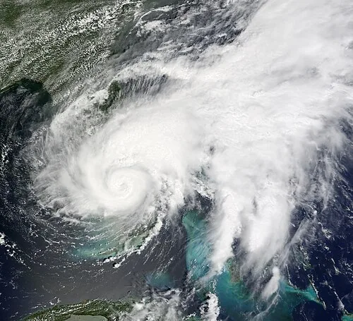
Tropical Storm Fay was a long-lived tropical cyclone that moved erratically across the state of Florida and the Caribbean Sea. The sixth named storm of the 2008 Atlantic hurricane season, Fay formed from a vigorous tropical wave on August 15 over the Dominican Republic. It passed over the island of Hispaniola, into the Gulf of Gonâve, across the island of Cuba, and made landfall on the Florida Keys late in the afternoon of August 18 before veering into the Gulf of Mexico. It again made landfall near Naples, Florida, in the early hours of August 19 and progressed northeast through the Florida peninsula, emerging into the Atlantic Ocean near Melbourne on August 20. Extensive flooding took place in parts of Florida as a result of its slow movement. On August 21, it made landfall again near New Smyrna Beach, Florida, moving due west across the Panhandle, crossing Gainesville and Panama City, Florida. As it zigzagged from water to land, it became the first storm in recorded history to make landfall in Florida four times. Thirty-six deaths were blamed on Fay. The storm also resulted in one of the most prolific tropical cyclone related tornado outbreaks on record. A total of 81 tornadoes touched down across five states, three of which were rated as EF2. Fay would cause around $560 million in damages throughout its lifespan.
Everything about Tropical Storm Fay →- Country
- United States